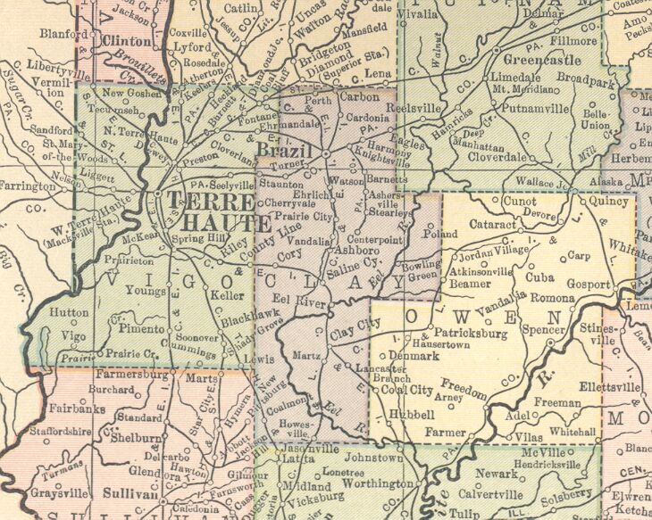
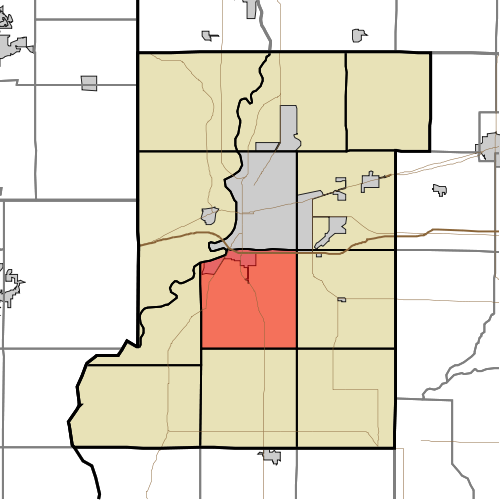
Riley Township is one of twelve townships in Vigo County, Indiana, United States. As of the 2010 census, its population was 3,123 and it contained 1,260 housing units.
Geography
According to the 2010 census, the township has a total area of 35.86 square miles (92.9 km2), of which 35.23 square miles (91.2 km2) (or 98.24%) is land and 0.63 square miles (1.6 km2) (or 1.76%) is water.
Cities, towns, villages
- Riley
- Terre Haute (southeast edge)
Unincorporated communities
- Keller
Adjacent townships
- Lost Creek Township (north)
- Posey Township, Clay County (northeast)
- Perry Township, Clay County (east)
- Pierson Township (south)
- Linton Township (southwest)
- Honey Creek Township (west)
- Harrison Township (northwest)
Cemeteries
The township contains six cemeteries: Cooper, Jones, Liberty, Mewhinney, Miner, and Oak Hill.
Lakes
- Lee Lake
- Wonder Lake
School districts
- Vigo County School Corporation
Political districts
- Indiana's 8th congressional district
- State House District 46
- State Senate District 39
References
- United States Census Bureau 2007 TIGER/Line Shapefiles
- United States Board on Geographic Names (GNIS)
- IndianaMap
External links